Plan it on site. Watch it grow.
Walk your property, note what grows there, sketch beds and plant regional plants. Then watch the garden grow, season by season, in 3D and AR.
Free and open source. Requires iOS or iPadOS 17 or later, or macOS 14 or later. GPS boundary walks and AR measuring need an iPhone or iPad; AR needs an ARKit-capable device, and no LiDAR is required.
From the property line to a planting calendar
Real screens from the app, in the order you would use them.
The field companion to the web planner
The app is not a copy of the desktop editor. Its strength is being on site: camera, GPS, compass, AR, offline notes and an instant review with whoever you are planning for.
Capture the site
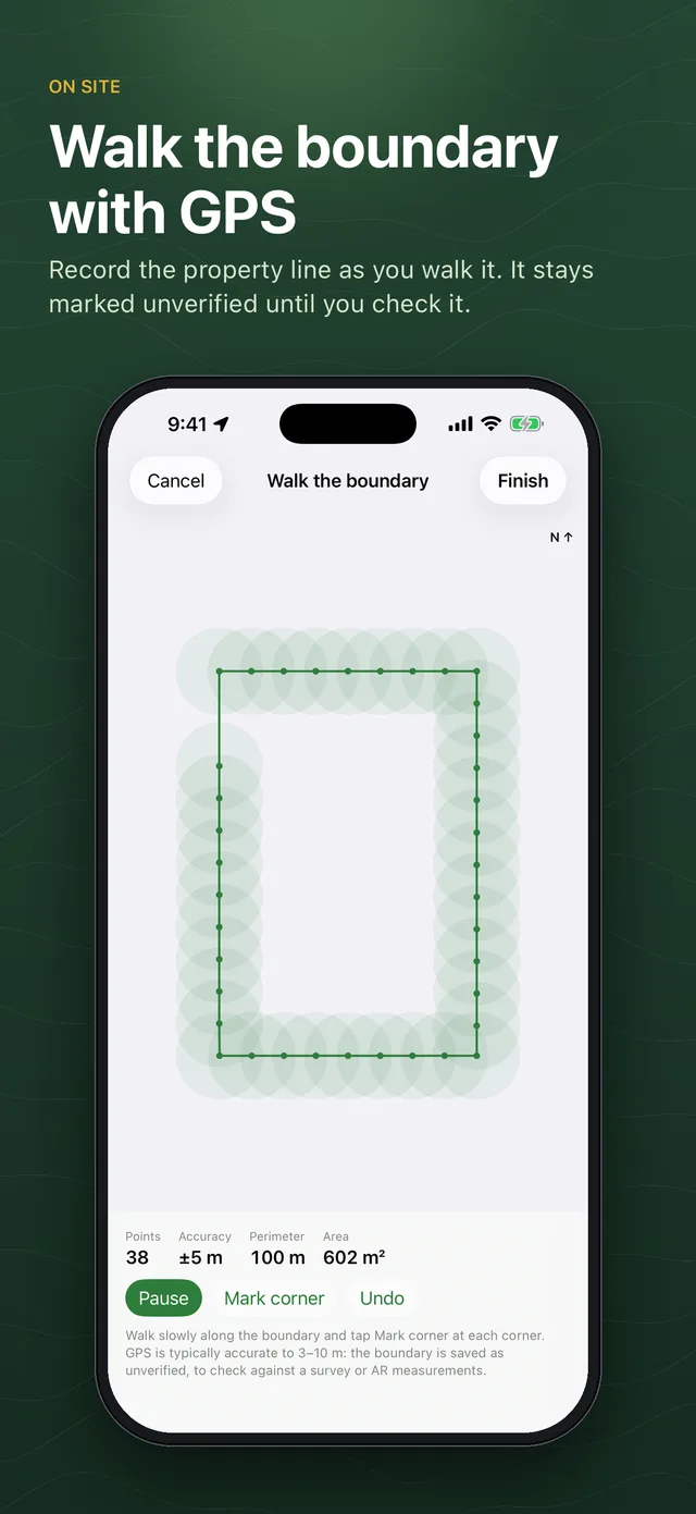
- Walk the property line with GPS, measure on the ground with AR, or type the size of the lot
- Boundaries from GPS and AR are marked unverified until you check them
- Your planting region, hardiness zone and frost dates come from your approximate location, and you can change them
- Open a house plan from OpenPlan3D and plan the garden around it
Work in the field, offline
- Notes, photos, issues and measurements, pinned on the plan, with GPS position and compass direction if you want
- Record existing trees and shrubs with their size and condition, and mark each one to keep or remove
- Field notes from two devices combine without duplicates
Design, then see it grow
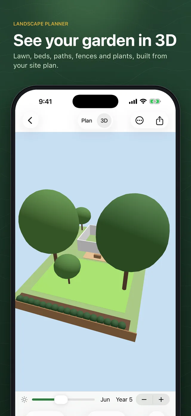
- Lawn, beds, mulch, gravel, patios, paths, decks, driveways and water; fences with gates, retaining walls, edging, pergolas, sheds, benches, pots and boulders
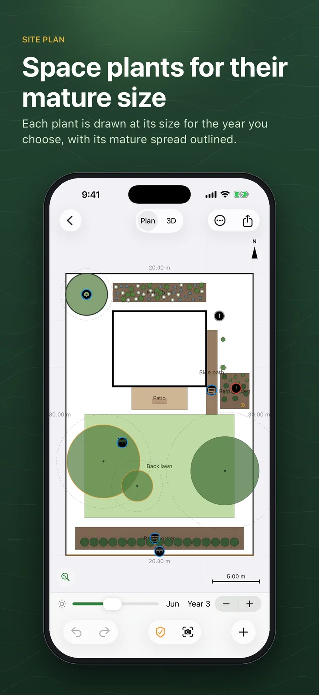
- Place single plants, hedges and rows, or mass plantings. Each plant is drawn at its size for the year you choose, with an outline of its mature spread
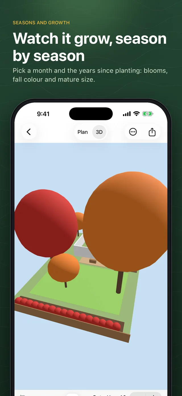
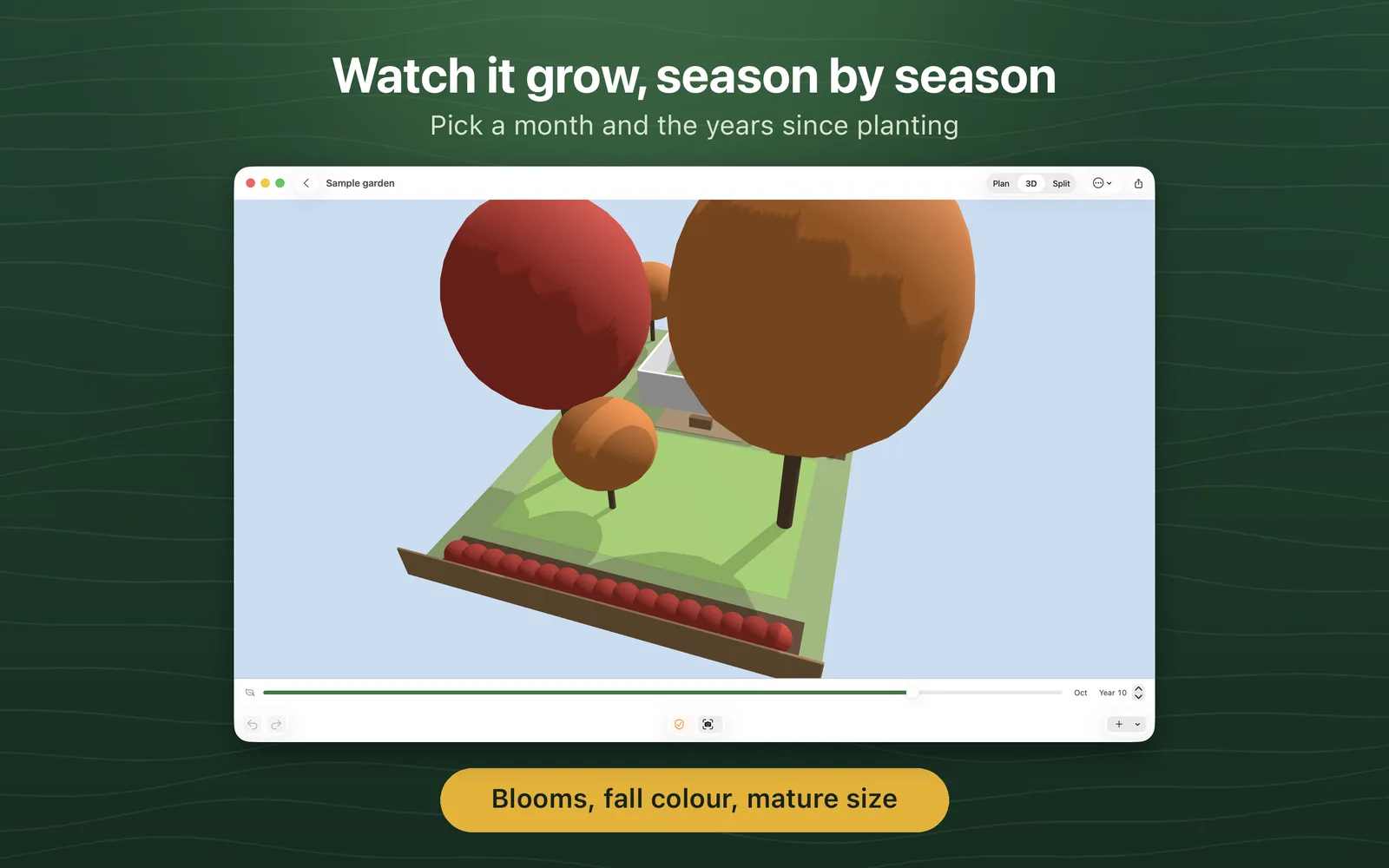
- Choose a month and the years since planting to see blooms, fall colour, winter branches and mature size
- Preview a plant or the whole design at true scale in AR, with a scale bar to check against a tape measure
Choose, check, schedule, share
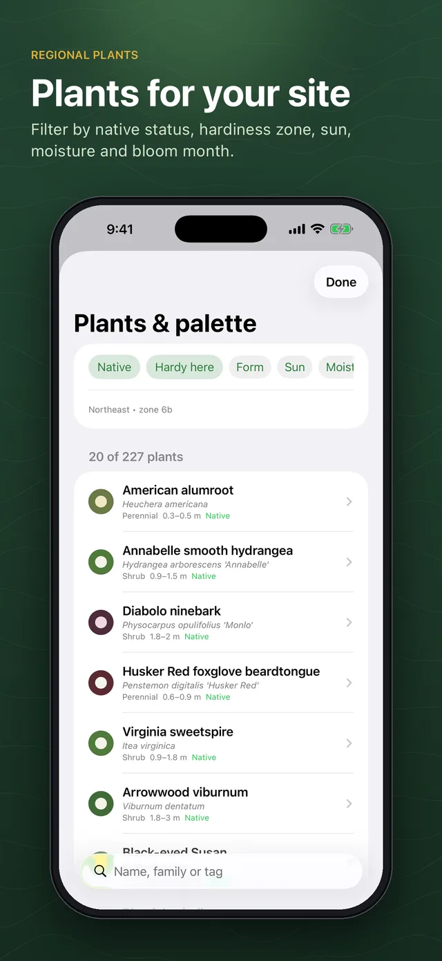
- Search a regional catalog of more than 200 plants for the U.S. Northeast, Southeast and Southwest by form, sun, moisture, native status, hardiness and bloom month
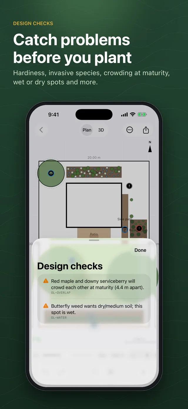
- Design checks flag plants outside your zone, plants listed as invasive, plants placed in paving, sun and moisture mismatches, crowding at maturity, trees too close to the house and bloom gaps
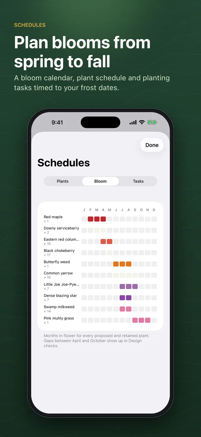
- Bloom calendar, plant schedule with quantities and a task calendar timed to your frost dates, exported as CSV
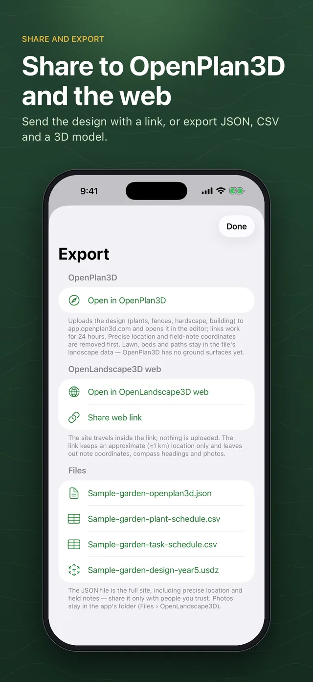
- Open the design in OpenPlan3D or in OpenLandscape3D on the web with a link, or export an OpenPlan3D file or a 3D model (USDZ)
Capture on iPhone, design on the big screen
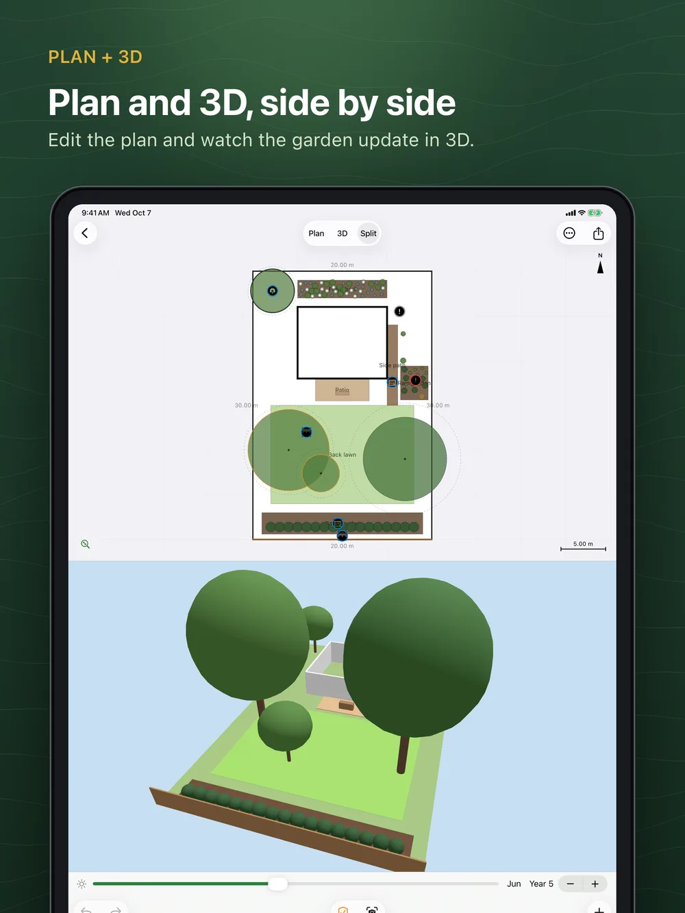
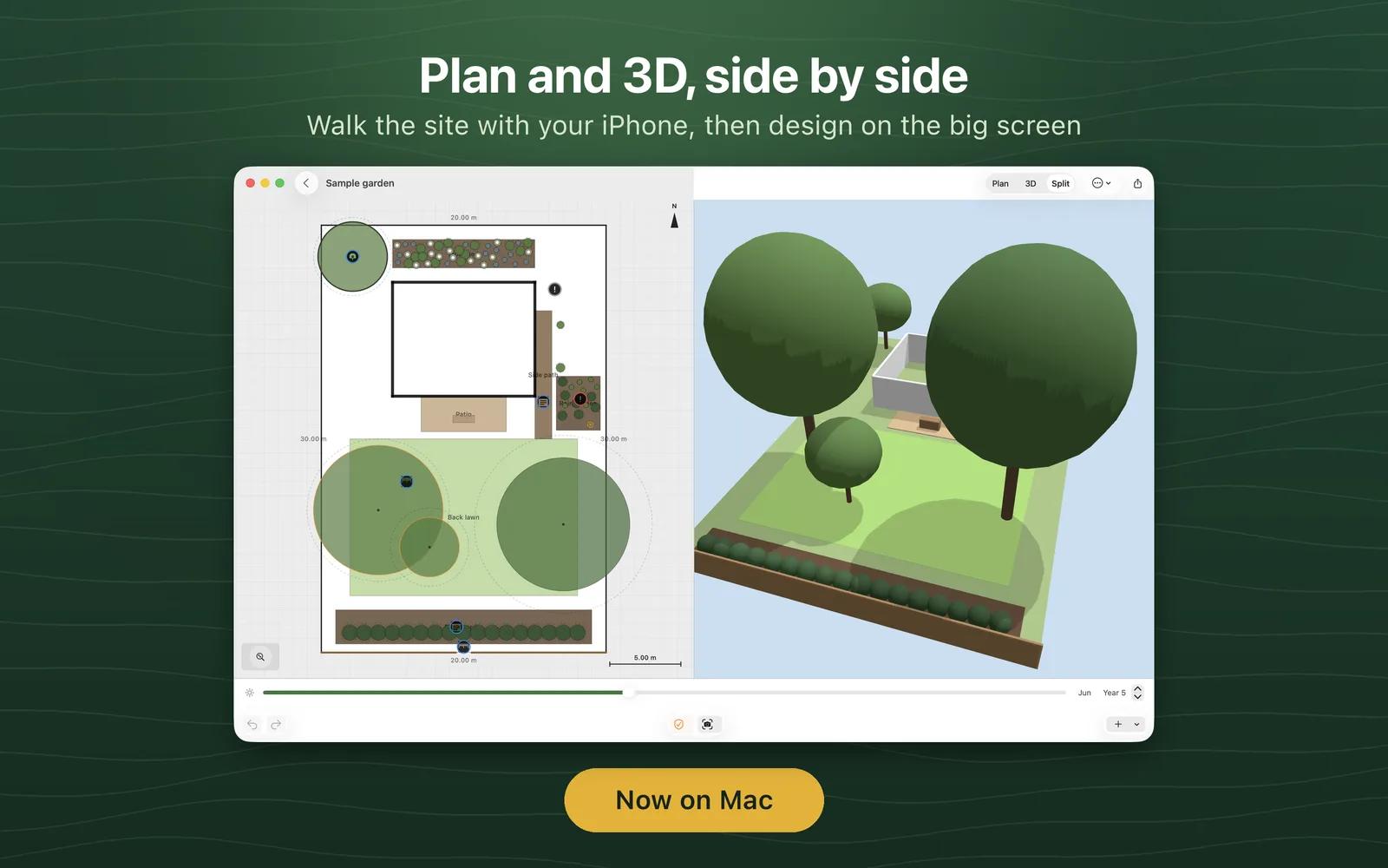
Plan and 3D side by side on iPad and Mac, with page-sized sheets for plants, checks and schedules, and keyboard shortcuts for undo, duplicate, rotate and the month and year. The Mac version is the same app, built for Mac: it opens sites captured on an iPhone or iPad with AirDrop, Files or a link, starts from the sample garden, draws lots and imports OpenPlan3D files. It cannot walk a boundary or measure with AR, because a Mac has no GPS or camera for that.
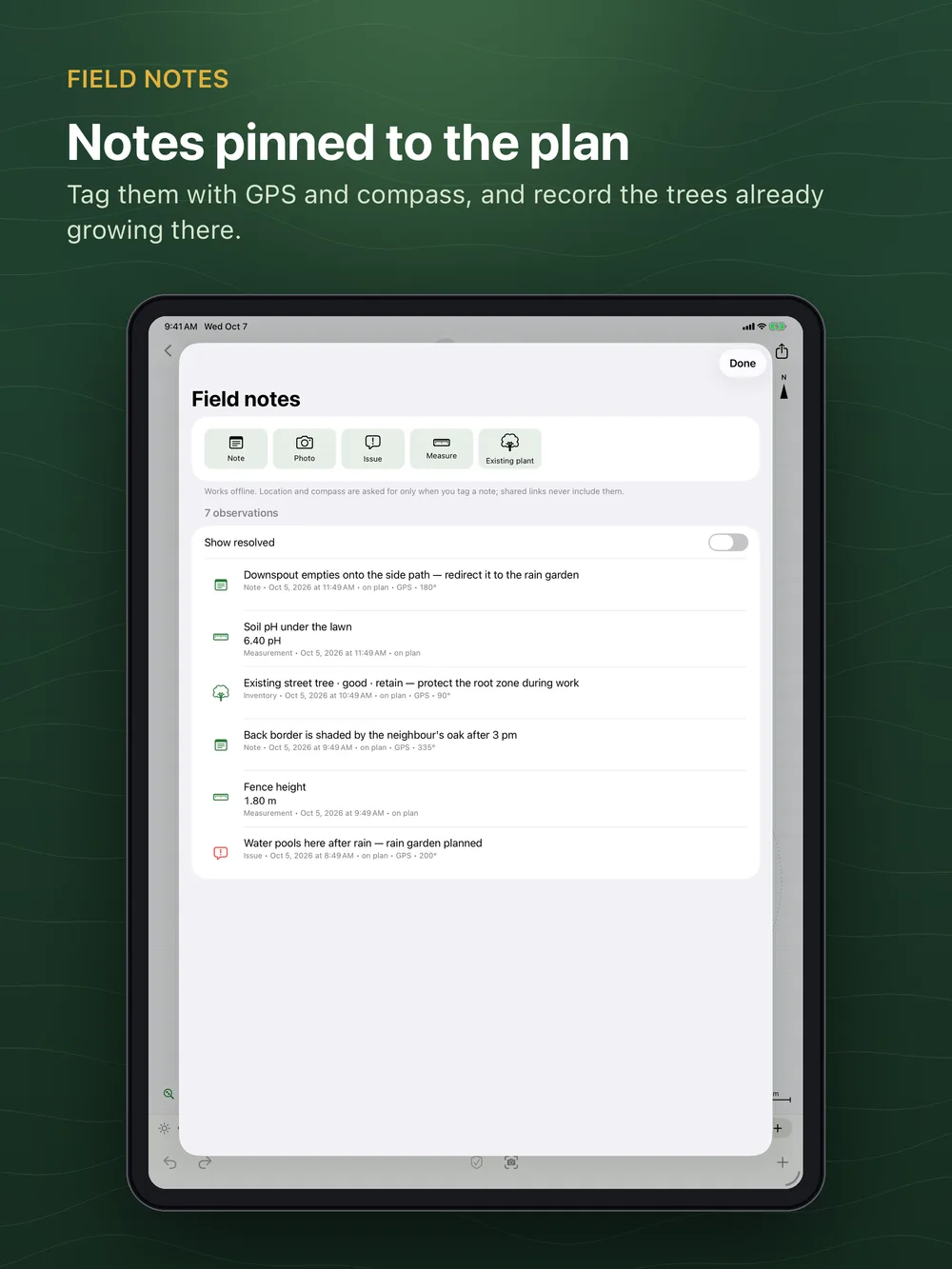
Notes that stay with the plan
Every note, photo, issue and measurement can carry a plan position, a GPS point and a compass heading. Existing trees go into an inventory with measured size and condition. When the same site comes back from the web or another device, field notes merge by id, so nothing is duplicated or lost.
Keep going on the web
Send a site from the app to the OpenLandscape3D web planner for drifts and grids, sun-and-shadow studies, saved alternatives, print sheets and high-resolution renders, then send it back. The design travels inside the link, with no server in between. Details are in the export format.
Private by design
No account. Your sites, photos and notes stay on your device until you share them. Shared links leave out your precise location and the location of your notes. The only upload is Open in OpenPlan3D, which sends the design, with the location rounded to about a kilometre, to app.openplan3d.com for 24 hours so the link works. You can delete all local data at any time in Settings. Privacy policy
OpenLandscape3D is open source (MIT) and works with OpenPlan3D. Plant data is an early, unreviewed compilation, so check local advice before planting. GPS and AR measurements are approximate and are not a survey. The app is being submitted to the App Store and will be linked here as soon as it is available. Until then, ask for a TestFlight invitation.